KML support
KML is a file format used to display geographic data in an Earth browser such as Google Earth. KML uses a tag-based structure with nested elements and attributes and is based on the XML standard. MapIt can display KML-data saved in the issue attachments, Mapit will try to parse attachments with .kml file ending. An option in the issue pop-up toggles the display of KML-files.
Make sure KML support has been activated for Mapit. Please contact the JIRA Administrator for this purpose.
Kml files in Mapit
-
Add the kml attachment to the correct JIRA issue
-
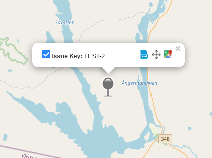
Go to Mapit and find this issue on the map
-
Click on the issue icon to open the popup
-
-
Click on the

-
Icon

A single JIRA Issue can contain multiple KML files.